Engineering Excellence, Every Step of the Way. Nexus Engineering General Trading and Contracting CO WLL is your partner for comprehensive engineering solutions.
Get to know us
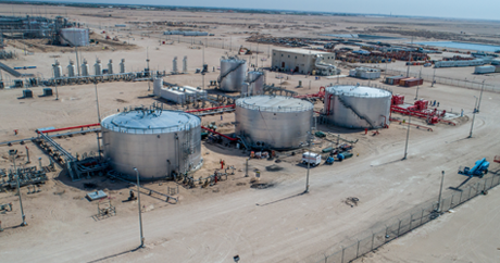
The Backbone of Excellence: Nexus Engineering's World-Class Facilities
ExploreShowcasing Excellence: A Glimpse into Nexus Engineering's Illustrious Project Portfolio
ExploreEngineering Excellence, Every Step of the Way. Nexus Engineering General Trading and Contracting CO WLL is your partner for comprehensive engineering solutions.
Get to know usThe foundation of every successful operation lies in the robustness of its infrastructure and facilities
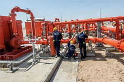
Every project tells a story; a narrative of challenges met, solutions crafted, and visions realized. At Nexus Engineering, our story is told through the myriad of projects we've successfully executed.
Headquarters
Nexs Enginnering
Ajial mall, Third Floor,Office C7-B
Block 11, Street 57,Fahaheel, Kuwait
+965 23913349 sales@nexusengkwt.comNEXUS CONSTRUCTION GROUP
Al Anoud Complex 5th Floor, office 501, Mecca Street, Fahaheel, Kuwait
+965 23913349 m.mounir@nexusengkwt.comSend
The foundation of any successful construction or engineering project lies in accurate surveying and mapping. At Nexus Engineering, we combine cutting-edge technology with seasoned expertise to deliver precise, reliable, and comprehensive surveying and mapping solutions. From topographical surveys to intricate land mapping, we ensure every measurement is exact.
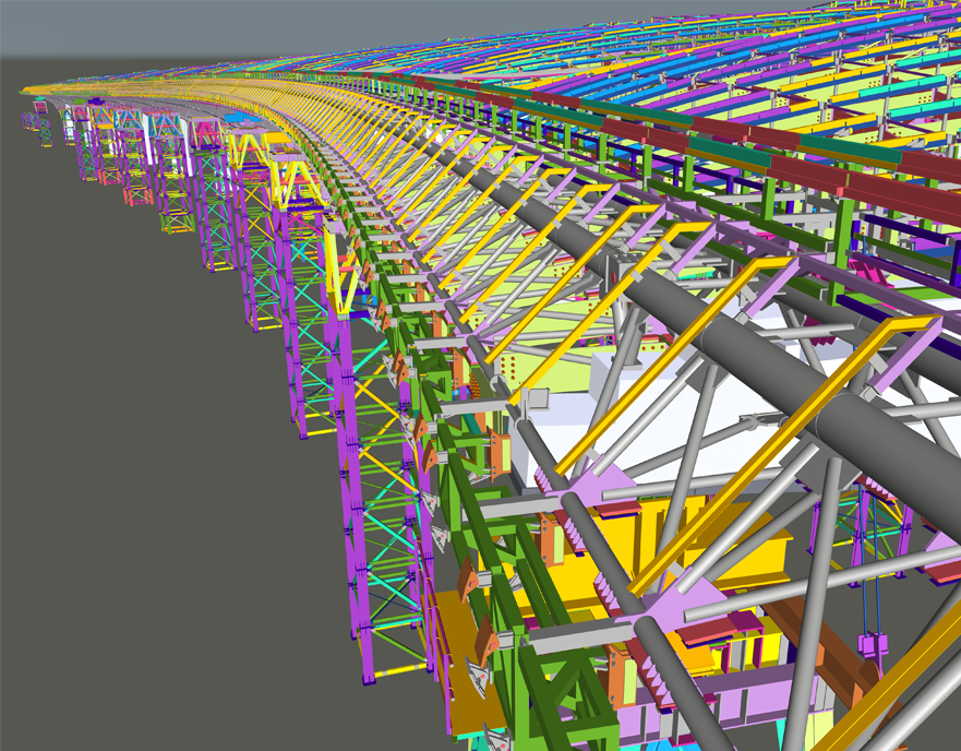
• Advanced Technology We employ the latest tools and technologies, from drones to laser scanners, ensuring utmost precision
• Experienced ProfessionalsOur team of surveyors and mappers bring years of experience, guaranteeing accuracy in every project.
• Customized Solutions Every project has unique needs. We tailor our services to match specific project requirements, ensuring optimal outcomes
• Comprehensive ReportingBeyond measurements, we provide detailed reports and visual representations, aiding in informed decision-making